Does the Oregon Trail
deserve protection and preservation in the State of Oregon?
by Stafford
Hazelett
copyright
©
2007
The Oregon Trail is romance
and reality. It is a metaphor for the American spirit of progress and
self-determination through democratic institutions. It is a metaphor for our
personal struggles in life. It is a computer game in every fourth grade
classroom. It is a major focus of the Oregon
tourism industry. Books about the Oregon Trail,
past and present, continue to be written. For some folks, it represents a
tangible connection to ancestors. People still come overland to Oregon to live at a rate
faster than they leave. Would the words “Oregon Trail”
still have meaning if the place itself and all of the views seen by the Native
Americans and the overland emigrants disappeared?
Professor Stephen Dow Beckham did a survey of emigrant
diaries for the Oregon Trail Coordinating Council in 1991and found these
representative entries. In the diary of William Watson, August 29, 1849:
"Some of us ascended the bluffs, from which we could see very plainly the
snow capped heights of Mount Hood, and also Mount Helen, which looked very
beautiful." In the diary of Harriet Buckingham, August 13, 1851:
"Camp to night on John Days river a pleasant stream, upon the mountain
just before we crossed the river we saw Mt. Hood towering high above the
Cascades, A beautiful snow capt Mt." In the diary of John Kerns, September
15, 1852: "Mounts Hood and St. Helens look as though ten miles' travel
would bring a person to them, but are about eighty miles off yet." In the
diary of Harriet Loughary, August 21, 1864: "To day reach Rock Creek where
we got a fine view of Mt. Hood, grand old sentinel of the Cascade Mountains.
Our guide tells us it is 16,000 feet above sea level."
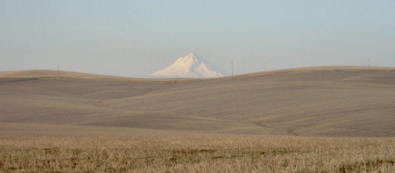
The unobstructed view seen by the overland emigrants to Oregon in the 1840s,
1850s, 1860s, and later, is still there today but now it is best seen on a
clear cold day in late winter. This photograph was taken in February 2006 at a
site which was documented by the Oregon State Highway Department in 1959 to
have visible rut traces of the Oregon Trail.
This site is scheduled for windmill construction in 2007.
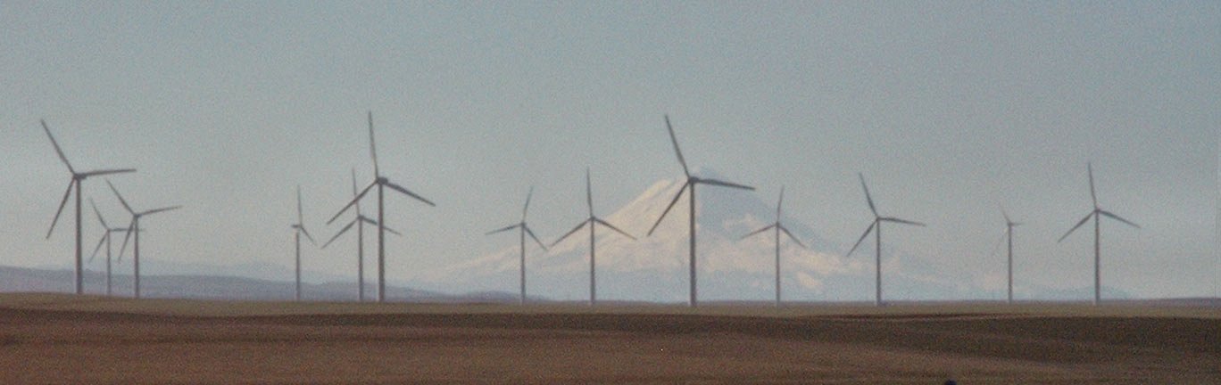
This site is on the Barlow Road Cutoff, an Oregon Historic Trail, south of the
first photo. Barlow Pass is visible on the left flank of Mt. Hood
through the windmill gap.
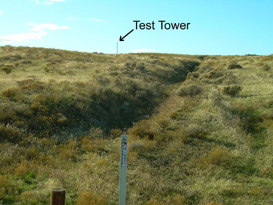
This site a few miles east of the John
Day River does not
have a view of Mt. Hood but it does have visible rut traces of the Oregon Trail. A windmill test tower is located at the top
of the ridge.